Defileul Mureșului Superior Natural Park
| Defileul Mureșului Superior Natural Parc | |
|---|---|
| Parcul Natural Defileul Mureșului Superior | |
IUCN category V (protected landscape/seascape) | |
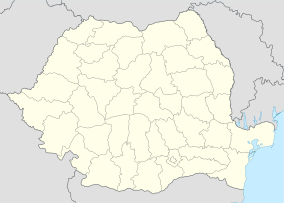
Location within Romania | |
| Location | |
| Nearest city | Deda |
| Coordinates | 46°57′43″N 25°05′31″E / 46.962°N 25.092°E[1] |
| Area | 9.156 hectares (22.62 acres) |
| Established | 2007 |
The Defileul Mureșului Superior Natural Park (Romanian: Parcul Natural Defileul Mureşului Superior; Hungarian: Maros-szoros Natúrpark) is a protected area (natural park category V IUCN) situated in Romania, in Mureș County.[2]
Location
[edit]The Natural Park is located in the superior course of the river Mureș, in the administrative territory of Deda, Răstolița, Lunca Bradului and Stânceni communes, in the north-eastern part of Mureș county.
Description
[edit]Defileul Mureșului Superior with an area of 9.156 ha[3] was declared natural protected area by the Government Decision Number 1143 on September 18, 2007 (published in Romanian Official Paper Number 691 on October 11, 2007)[4] and represent an area the very tight portions, with volcanic blocks, with high and steep slopes, with flora and fauna specific Eastern Carpathians
See also
[edit]References
[edit]- ^ eunis.eea.europa.eu – Defileul Mureşului Superior Natural Park (Defileul Topliţa-Deda, coords); retrieved on June 11, 2012
- ^ Defileul Mureşului Superior Natural Park (location) Archived 2014-02-01 at the Wayback Machine; retrieved on June 11, 2012
- ^ (in Romanian) apmms.anpm.ro – Agenţia pentru Protecţia Mediului Mureş; retrieved on June 11, 2012
- ^ (in Romanian) posmediutm.ro – Ministerul Mediului şi Pădurilor – Legislaţie Archived 2012-07-21 at the Wayback Machine; retrieved on June 12, 2012


